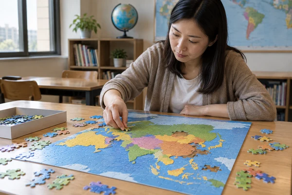
A custom geography puzzle needs two approvals: the map must communicate accurate, appropriate content, and the printed, cut product must remain readable and usable at its finished size. Begin with the learning objective and an identified map source, then approve projection, labels, boundaries and supporting instructions before production. This guide helps education publishers and classroom-kit buyers manage that process. It explains how to turn a map into an activity without assuming that a publicly available dataset, attractive digital image or piece-count choice automatically establishes educational suitability or destination-market compliance.
Define the task for a custom geography puzzle
Choose what learners will do with the completed map. They might locate regions, compare physical features, follow a route or discuss relationships between places. Those tasks need different visual information. A map intended to show mountain ranges should not become crowded with every available political label, while a capital-location activity needs an appropriate naming and reference strategy.
State the intended audience and teaching context. A supervised classroom kit differs from an independent family retail product. Record who introduces the activity, what reference materials are available and how much table space the setting provides. The learning brief should guide format and support materials before the supplier is asked to recommend a piece count.
Decide what successful use looks like operationally. A teacher may need learners to point to a location and explain a feature after assembly, or simply use the image as a discussion prompt. Describe the invitation clearly without promising that puzzle assembly alone delivers a curriculum outcome. Any assessment design belongs to the educator or publisher responsible for the learning programme.
The educational puzzle format provides a starting point for a map, guide and reference system. For a custom map puzzle for kids, also define the intended age range and destination market. Those inputs require a qualified product review; neither the educational theme nor staff supervision replaces applicable requirements for the physical product.
Keep the map focused
Write a must-show list and a could-show list. Put the main learning information on the puzzle, then assess whether optional facts belong on a separate card. This creates a hierarchy that editors can review and designers can execute. It also makes later revisions easier because a change to supplementary content need not silently alter the approved map face.
Record the map source and editorial scope
Create a source register identifying dataset or artwork provider, version, access date, permitted use and any required attribution. A map downloaded from an image search is not an adequate source record. Determine whether the files include editable geographical data, a finished map or only a preview. Different assets support different degrees of review and adaptation.
The Natural Earth project describes its raster and vector map data as public domain. It also acknowledges updates and omissions. Public-domain status can clarify one permission question; it does not guarantee that a chosen dataset contains the detail, current names or editorial presentation your product needs. Review the selected data and any additional assets separately.
Assign editorial responsibility for factual content. The publisher or appointed specialist should approve place names, selected features, language conventions and the date represented. Keep a list of intentional omissions and simplifications. A manufacturing supplier can flag tiny text or a file mismatch, but should not be expected to decide which geographic facts are suitable for the curriculum.
Avoid building a source register only after the artwork is final. Map design can conceal the origin of a boundary or label when layers are merged. Preserve the relevant references as the work develops, then connect them to the released edition. This helps a future editor distinguish an intentional teaching simplification from an accidental production or content error.
Approve projection, extent and boundary treatment
Choose the geographic extent and projection according to the lesson. A world map, a regional physical map and a local route map serve different comparisons. The U.S. Geological Survey explains that map projections distort different geographic properties. Identify which properties matter for the intended activity instead of presenting a flat world map as preserving all relationships equally.
If the map uses insets, indicate their role clearly. An enlarged island or detached region can improve visibility, but its position or scale may differ from the main map. Editorial notes should explain that relationship where necessary. Do not place an inset purely to fill empty space if doing so encourages a mistaken interpretation of distance, orientation or location.
Boundary treatment requires explicit editorial approval for the intended market and audience. Natural Earth describes a de facto and disputed-boundary policy, illustrating that dataset presentation involves choices. Review the source's policy and your product requirements. Do not assume a factory or a stock map can resolve contested representation questions for every destination.
Record the approved extent, projection, boundary approach and inset arrangement in the release notes. Historical maps also need the period represented. These decisions should remain visible when artwork is resized or localised. A later designer may otherwise remove a note or change an inset without realising that the adjustment affects the meaning of the educational content.
| Element | Question to answer | Approval record |
|---|---|---|
| Source | Which dataset or artwork version? | Provider, date and permissions |
| Projection | Which properties matter to the lesson? | Chosen projection and relevant explanation |
| Boundaries | What presentation applies to this edition? | Market and editorial approval |
| Labels | Which names and language conventions? | Controlled naming list |
| Insets | How do scale and position differ? | Approved layout and explanatory notes |
Share the map and learning brief
Send the intended users, learning task, map source and label requirements. Include the guide, language editions and quantity scenarios so the complete resource can be reviewed.
Review labels for custom puzzle map printing
Custom puzzle map printing should be reviewed at the intended finished scale. A map that looks clear on a zoomable screen can become crowded on paperboard. Check type size, line weight, contrast and relationships between labels and features. Judge the printed result under practical viewing conditions, rather than selecting a universal minimum font size without considering the design and output process.
Use a label hierarchy that matches the objective. Primary locations should be easy to identify; supporting labels should not compete equally for attention. Where space is limited, a number or symbol can connect to a separate legend, but that introduces an additional reading task. Have the education editor decide whether the legend supports the activity or creates avoidable complexity.
Overlay the proposed cut pattern during artwork review where the workflow allows it. Important names may cross cuts, and small labels can fall on narrow piece areas. Decide which text must be readable before assembly and which belongs to the completed image. Move essential instructions to a guide if their visibility cannot depend on the puzzle's current assembly state.
The puzzle artwork requirements guide covers source quality and template preparation. For maps, add an editorial text check after every layout adjustment. A label moved for print clearance can end up pointing to the wrong feature. Technical preflight and factual proofreading are complementary reviews, and both should reference the same final output.
Adapt the method for science, history and language
A custom science puzzle may use a map to show biomes, water systems or other spatial themes. Identify whether features are simplified, approximate or time-dependent. Use a relevant source and editor for the chosen subject rather than assuming geographic data supplies every scientific fact. The guide should explain the selected scope without presenting an illustrative distribution as precise measurement.
A custom history puzzle needs a defined date or period. Present-day boundaries and names may not suit the historical task, and a single map may combine information from different dates unless controlled carefully. Approve the temporal scope and describe any necessary simplification. Keep supporting text separate from modern product-market information so a history note is not mistaken for a current geographic claim.
A custom language learning puzzle can support reading and discussion through place names or selected vocabulary. Decide whether bilingual labels appear together, use separate keys or require different editions. Review translations, spelling and font support with qualified language reviewers. Avoid filling every available space with parallel text if it makes both languages difficult to read at the physical scale.
Across subjects, the projection question remains relevant when a geographic map is involved. The USGS projection guidance provides context for discussing shape, area and distance distortion. The educational team should decide which interpretation the activity needs and explain it appropriately; the puzzle format itself does not correct a misleading map choice.
Plan a guide that makes the activity usable
A guide should explain what to do before, during and after assembly. Start with the intended activity and reference needs, then provide a short set of optional prompts. Avoid turning the insert into an overloaded mini-textbook. Teachers and families need to locate the relevant instruction quickly and understand whether the puzzle is a location task, discussion resource or broader lesson component.
Use an answer reference consistent with the exact puzzle edition. If a label list changes, update the answer card and any translations together. Include a version identifier that staff can recognise. For several classroom sets, confirm which reference belongs to which product, especially when different regional or language editions use visually similar box designs.
Plan physical setup with the actual sample. Check table space for loose pieces and guides, reference visibility and how groups return components. Classroom-kit buyers may need individual set identifiers and a multi-set carton arrangement. Retail buyers may need a pack that stores neatly at home. Those configurations can share artwork while still requiring separate packing instructions.
Review the intended user and market with the responsible compliance team. The U.S. Consumer Product Safety Commission's toy guidance explains that firms must identify applicable requirements for their specific product. An educational label does not establish exemption or conformity. Our children's-puzzle documentation guide outlines related procurement questions.
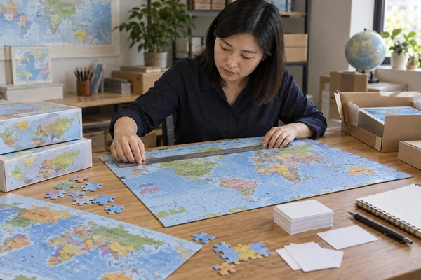
 PuzzleZa
Approve editorial and physical evidence together
Use separate review records for factual content and physical product condition, then release them together. The editor checks names, features, source correspondence and supporting explanations. The product reviewer checks print clarity, cut registration, piece separation, board condition and pack fit. Neither reviewer should infer that the other approval covers its own responsibility.
Keep a controlled label list for proofreading. Review every required name against the final printed proof and the source, not only against a earlier draft. Pay particular attention to similar names, diacritics and labels moved near cut lines. Record corrections in the artwork version log so a factory cannot accidentally print an older map after the guide has been updated.
Ask reviewers to test the specific activity with the sample where appropriate. Can the required feature be located? Does an inset need explanation? Is the reference usable on the intended table? These are usability observations, not a formal study of educational effectiveness. Document them honestly and modify the activity or product where the review reveals a concrete obstacle.
Before release, resolve open questions about the map edition and its maintenance. If the dataset is updated later, decide whether that affects your current product rather than automatically replacing artwork. Maintain a review owner and source register. This allows a future reprint to evaluate content changes deliberately while keeping remaining stock and customer descriptions traceable.
Control production, classroom sets and future editions
Factory testing can compare selected production units with the released map, product and pack references. Confirm the map revision, correct guide, cut and component presence. At shipment inspection, check selected finished units and cartons for edition, assortment, visible condition and agreed marks. Inspectors need the approved visual reference as well as the written title of the educational programme.
Give the receiving team a clear allocation list for regional and language editions. If multiple classroom sets are packed together, identify the count and component configuration. A school distributor should not have to open every unit to discover which map version is inside. Agree labels and carton marks before packing, and avoid inventing market or importer details that responsible parties have not supplied.
Retain source notes, approved files, sample references and inspection observations for reprints. Review new names, changed content or requested localisations with the relevant editor. Do not silently exchange a current map for a historical one or replace a boundary treatment under the same product description. Create a controlled revision and update affected references and retail information.
PuzzleZa is an 8,000 m² custom puzzle factory in Shenzhen. Review the factory information and send an educational map brief with the audience, learning task, approved sources and components. A clear editorial record gives the manufacturer a reliable definition to reproduce and the education team a useful basis for future review.
Frequently asked questions
What map source should an educational puzzle use?
Choose a source whose content, detail and permitted use suit the intended lesson. Record its provider, version and date, then review names, boundaries and simplifications with an appropriate editor. Public availability or public-domain status does not by itself establish factual completeness, current accuracy or suitability for your audience and market.
Do map labels need to avoid every puzzle cut line?
Not necessarily, but their readability should be reviewed at the finished scale and in the intended activity. Decide which labels must be readable before assembly. Adjust layout or move essential information to a guide where needed, then proofread the final output to ensure that relocation has not changed the label's meaning.
Can one world-map projection suit every learning objective?
No flat projection preserves every geographic property without distortion. Select the projection according to the relationships learners need to discuss, such as area, shape or distance. Explain relevant limitations in an appropriate reference. The education editor should approve the choice rather than relying on the manufacturer's default stock map.
Can the same puzzle support geography and language learning?
Potentially, if the content and instructions remain clear. Identify the primary task, select the vocabulary and have qualified reviewers check translations and spelling. Bilingual text may need a separate legend or edition when space is limited. Avoid assuming that additional labels automatically create a more useful learning resource.
Does classroom use remove children's-product requirements?
Do not assume it does. Applicable requirements depend on the physical product, intended users and destination market. Define those inputs with qualified specialists before release, including the necessary testing, documentation and labelling. A school setting, educational theme or supervision statement does not by itself establish the product's compliance status.
Conclusion
A custom geography puzzle should begin with an approved learning brief and end with a controlled map edition. Record source, projection, names and boundary decisions, then review the printed labels and cut product together. Keep the guide, packing and market-specific review aligned so teachers and buyers receive the educational resource they actually approved.
Discuss your educational map puzzle
Contact PuzzleZa at info@PuzzleZa.com with approved content and format ideas. We can discuss the manufacturing scope, sample checks and packing requirements for your programme.
Sources and scope
Sources reviewed on 2026-09-28. Manufacturing examples and review checklists are planning guidance, not claims about completed customer projects or guaranteed results. AI-generated images illustrate the topic and do not document an actual inspection.
- Natural Earth: data, updates and boundary policy — Public-domain data status and the need to review updates, omissions and boundary presentation.
- U.S. Geological Survey: uses of map projections — Projection selection and distortion of geographic properties.
- U.S. Consumer Product Safety Commission: toy safety business guidance — Identifying requirements applicable to the specific children's product.